Please report broken links!


SOL Review
Unit 1--Geography
-
Oceans

-
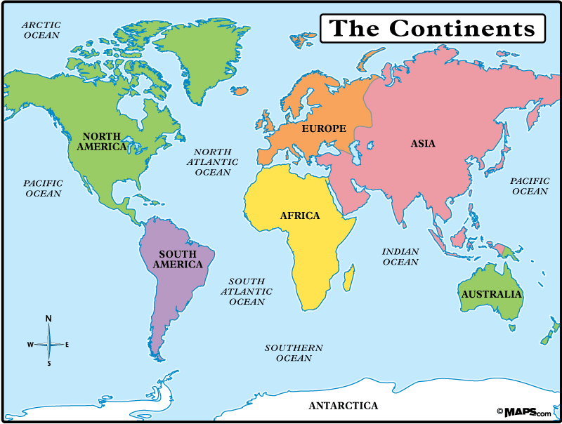
Map of the Continents
-
Longitude and Latitude
-
Landsat 7 NASA Satellite Imagery Homepage
-
Satellite Photos of Geographic Features
-
Links to many other maps sites
-
Looking at the world from a different perspective
-
Practice naming these continents
-
Archaeology for Kids
Photos from the Eight Geographic Regions of North America
-
Map of the Eight Geographic Regions of North America
-
1. Coastal Range (Big Sur, California)
-
1. Coastal Range (farming in the San Joaquin Valley between the ranges)
-
2. Basin and Range (Grand Canyon)
-
2. Basin and Range (Another view of the Grand Canyon)
-
2. Basin and Range (Death Valley)
-
2. Basin and Range (Nevada landscape)
-
3. Rocky Mountains
-
3. Rocky Mountains
-
4. Great Plains
-
4. Great Plains (dry grasslands)
-
5. Interior Lowlands (along the Ohio River--Gateway to the West)
-
5. Interior Lowlands (Iowa)
-
6. Coastal Plain (wetlands in Louisiana)
-
6. Coastal Plain (South Carolina)
-
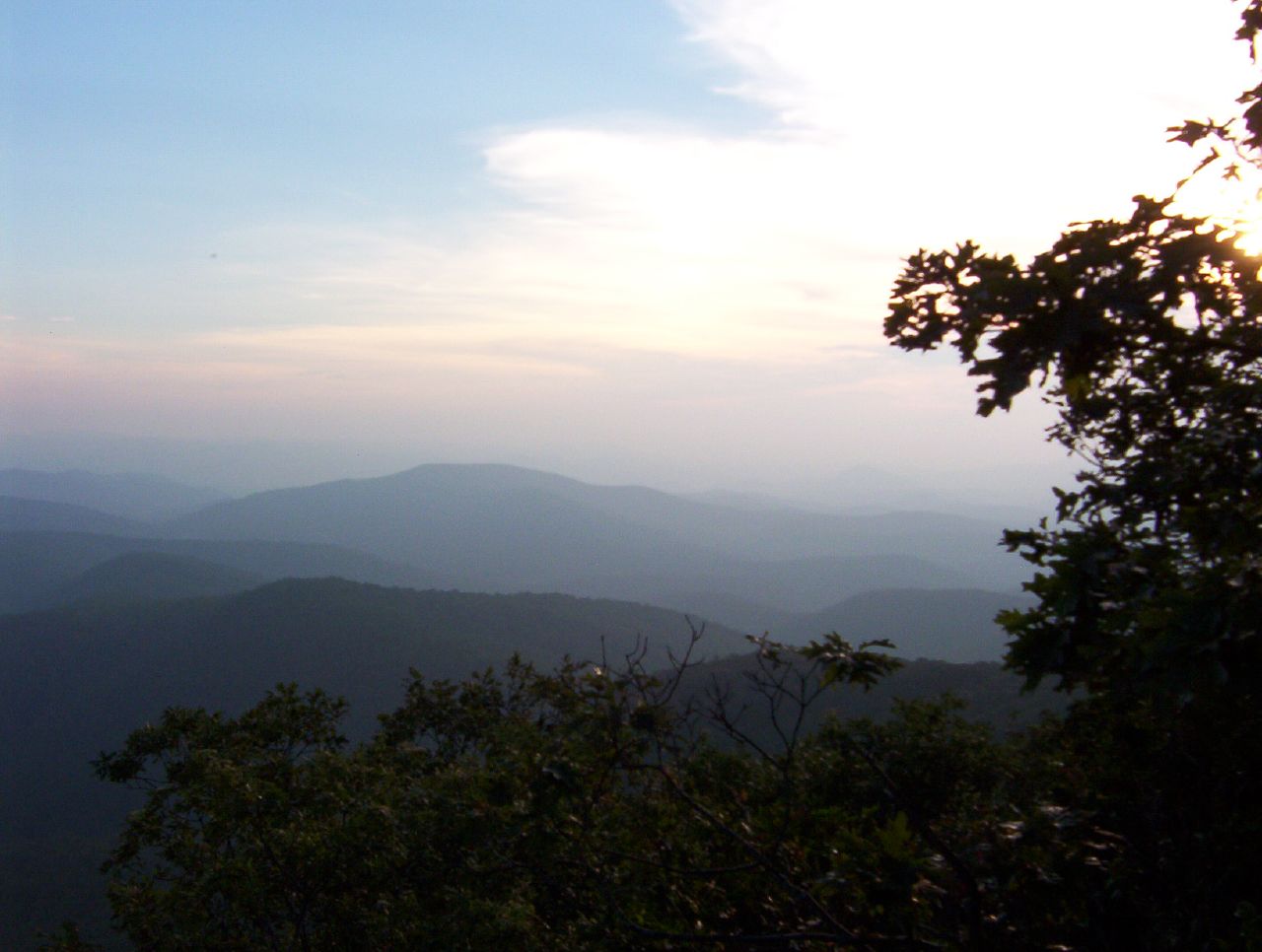
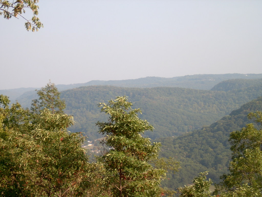
7. Appalachian Highlands
-
7. Appalachian Highlands
-
8. Canadian Shield (lakes on the Canadian Shield)
-
8. Oldest rock formations in North America (metamorphic gneiss)
-
8. Athabasca Glacier (Though not a part of the Canadian Shield, this Alaskan ice mass shows what a glacier is like.)
-
North America in relief (Can you find the 8 regions?)
.jpg)
Unit 2--Native Americans
-
Beringia (now under the Bering Strait)
-
The First Americans (also called Native Americans and American Indians)
-
Routes of the First Americans
-
Timeline of Early Native American History
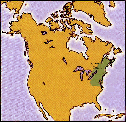
Iroquois (Oneida, Seneca, Mohawk, Cayuga, Onondaga, Tuscarora)
-
Location of the Iroquois (Eastern Woodlands)
-
Image of an Eastern Woodland forest
-
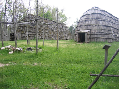
Iroquois longhouse illustration
-
Longhouse (modern reconstruction)
-
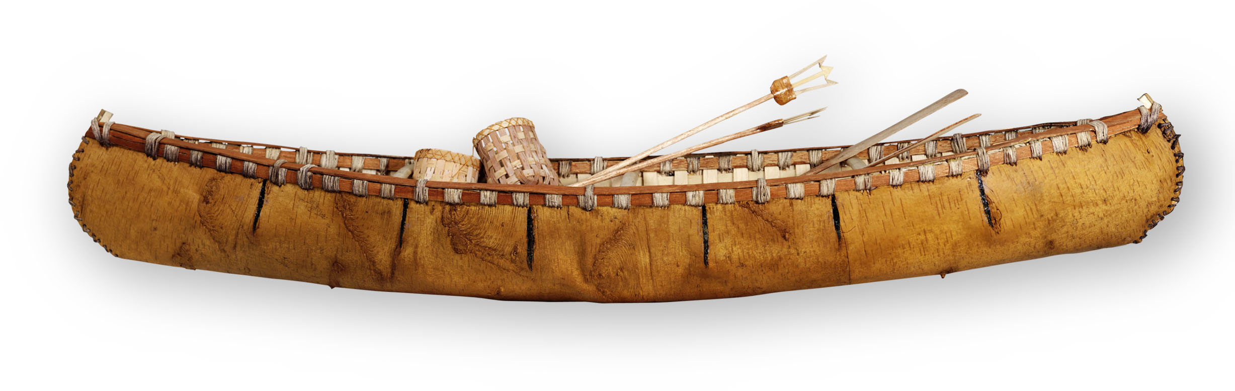
Birch bark canoe replica
-
Diet of the Iroquois included beans, corn, pumpkin, berries, fish, small game, bear and . . . (click to find out)
-
More links to information on the Iroquois
-
Inside a replica of a longhouse
-
Iroquois longhouse reproduction
-
Facts about the Iroquois
Sioux (such as the Lakota, Dakota and Nakota)
-
Location of the Sioux (Great Plains)
-
Image of the Great Plains (southern Colorado)
-
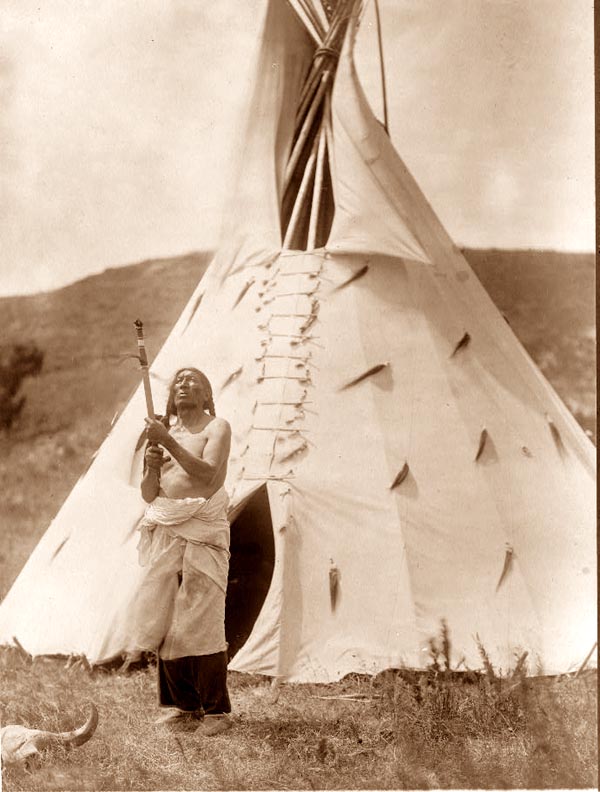
Sioux Indian of the Great Plains and tipi photograph
-
Plains Indians dress (bison hide and shells)
-
Uses of the bison (or American buffalo)
-
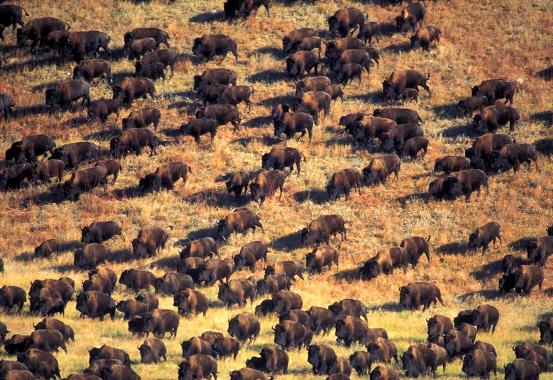
Herd of buffalo (bison) on the Great Plains
-
Sioux woman with a dog travois
-
More links to information on the Sioux
-
Facts about the Sioux
Pueblo (such as the Hopi and the Zuni)
-
Location of the Pueblo (Desert Southwest)
-
Image of the Desert Southwest region (includes the Colorado River)
-
Pueblo village
-
Mesa Verde cliff dwellings (Anasazi--ancestors of the Pueblo builders)
-
Close-up view of Mesa Verdi
-
Diet of the Pueblo Indians was 80% . . . (click to find out)
-
Woven blanket typical of Pueblo Indians
-
Pueblo Indian pottery (example shown is believed to be about 1000 years old)
-
Kachina doll
-
Woven basket
-
More links to information on the Pueblo
-
Facts about the Pueblo
Kwakiutl
-
Location of the Kwakiutl (Northwest Coast)
-
Image of the Pacific Northwest Coast
-
Kwakiutl modern-day plank house
-
Another plank house of a Pacific Coast tribe
-
Kwakiutl Art (mask)
-
Kwakiutl people ate a lot of . . . (click to find out)
-
Giving it all away--the Kwakiutl potlatch
-
The Kwakiutl made canoes, totem poles, plank houses, and more out of cedar trees from . . . (click to find out)
-
More links to information on the Kwakiutl
-
Facts about the The Kwakiutl
Inuit (Eskimo)
-
Location of the Inuit (Arctic region)
-
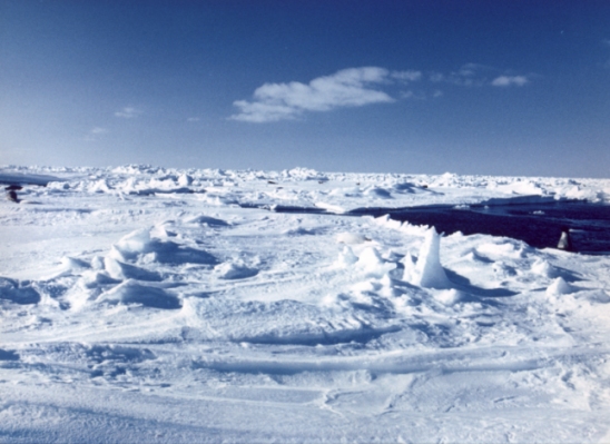
Image of the Arctic region
-
Inuit winter sod and ice house
-
Inuit summer tent dwelling
-
Inuit clothing photograph (mainly furs and hides)
-
Inuit in a boat called an umiak (notice the harpoon to hunt sea mammals)
-
Inuit ate caribou, bear, fish and also . . . (click to find out)
-
Inuit also ate . . . (click to find out)
-
A sea mammal of the Arctic region (the narwhal).
-
More links to information on the Inuit
Tools of Stone and Bone
Unit 3--Early Explorers
-
Explorers
-
Explorers of North America
-
European explorers were seeking a faster route to Asia to trade for silk, tea and . . . (click to find out)
-
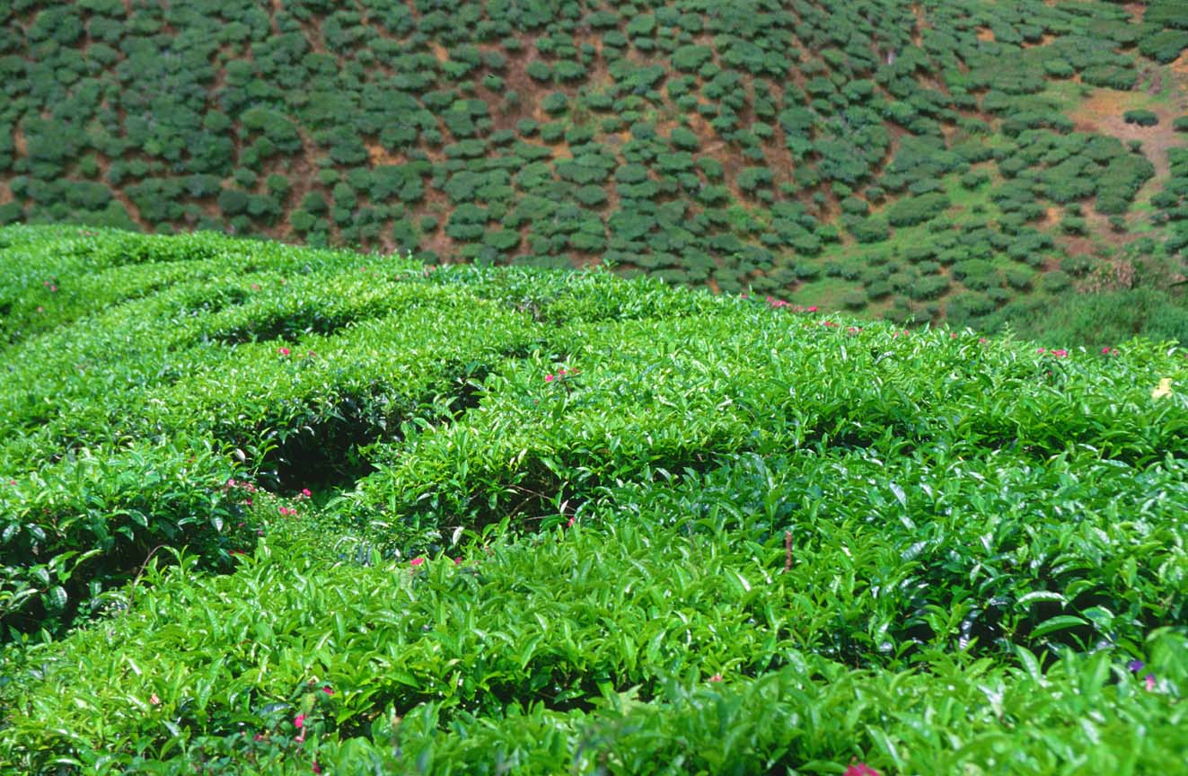
Asian tea plantation
-
A silk worm and a silk worm cocoon
-
Portrait of a woman wearing silk
-
Gems (cut and uncut emeralds)
West African Kingdoms
-
Map of Ghana, Mali, Songhai (kingdoms that became powerful by controlling trade in West Africa)
-
Ancient Mali
-
Ghana, Mali and Songhai
-
West Africa and the trading of gold and salt for goods from Europe (animated map)
-
Gold from Ghana
-
Ghana, Mali, and Songhai (a brief history of the three West African kingdoms)
-
A History of Salt (with photos of salt in nature)
-
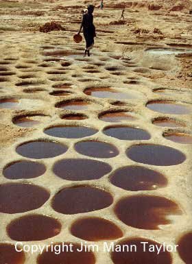
Saharan salt mine
-
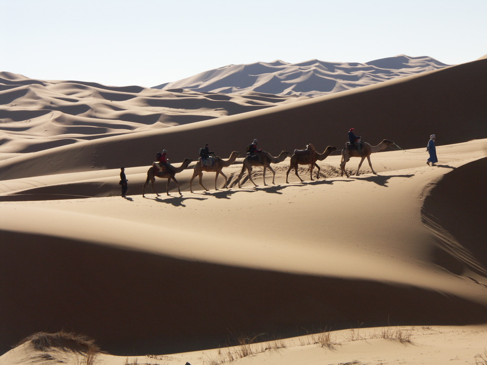
Caravan across the Sahara Desert
Exploration by the Portuguese
-
Prince Henry, Bartolomeu Dias and Vasco da Gama (three men from Portugal who changed the world)
-
Prince Henry the Navigator (who established a school for Portuguese explorers and cartographers)
-
Vasco da Gama (Portuguese explorer who reached India by sailing around the southern tip of Africa)
-
Map of Africa (showing the routes of Dias and da Gama)
Obstacles and Problems of Early Explorers
-
Poor navigational tools (Can you name any of the tools in the picture?)
-
Description of some of the tools used to find latitude and longitude
-
Disease and starvation were obstacles for explorers (click here to learn about scurvy).
-
Fear of the unknown was an obstacle for explorers (click here to read about how some explorers died on their journeys of exploration).
Exploration by the Spanish
-
The World in 1492 (as far as the Europeans knew!)
-
Christopher Columbus (Spanish explorer who hoped to get to Asia by sailing West instead of East)
-
Replicas of the Nina, the Pinta, and the Santa Maria (notice the sails)
-
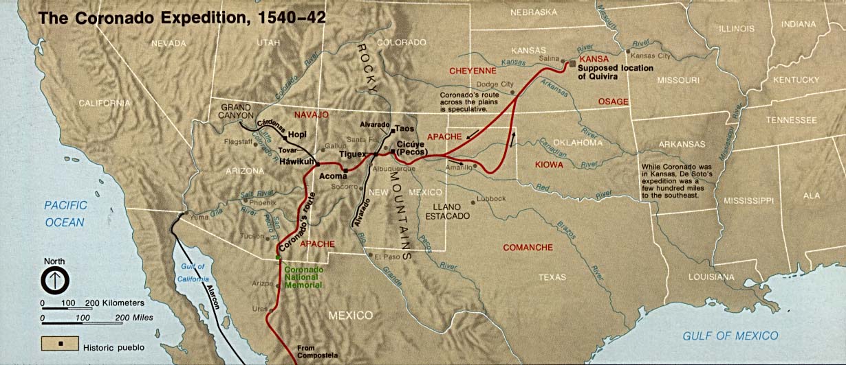
Francisco Vasquez de Coronado (Spanish explorer who saw the Grand Canyon but didn't find gold)
-
Map of the Coronado Expedition
Exploration by the English
Exploration by the French
-
Samuel de Champlain--founder of Quebec
-
Map of the voyages of Samuel de Champlain (founder of the city of Quebec)
-
Sieur de La Salle (French explorer of the Mississippi River)
-
Samuel de Champlain (illustration)
-
Exploration routes of La Salle (French explorer who claimed the Mississippi River and its tributaries for France)
-
Area of North America called "New France" (including the land called Louisiana)
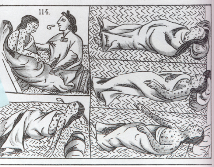
Reasons for Exploration and the Columbian Exchange
-
European rulers wanted more wealth from resources, especially gold and silver (photograph of old Spanish coins)
-
European rulers wanted more wealth from resources, such as furs (advertisement for beaver felt hats)
-
European leaders wanted more wealth from resources, such as fish (Atlantic cod)
-
European leaders wanted more wealth from resources, such as Virginia
-
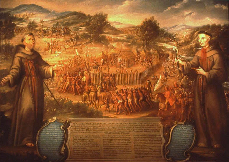
European rulers wanted to spread Christianity (click to see a 1765 painting of San Saba)
-
Europeans wanted to spead their Christian religion (diagram of Catholic missions in California, part of New Spain)
Accomplishments of Early Explorers of North America
-
Better Maps and More Knowledge of the World (example: Martin Waldseemuller
-
Better Maps and More Knowledge of the World (Samuel de Champlain
-
Better Navigational Tools and Ships (click to see models of ships of the 1400s and 1500s)
-
European countries claimed land in North America (click to see the map of lands claimed by Spain, France, and England).
Cooperation between Natives Americans and Explorers
Conflict Between the Native Americans and the Europeans
Unit 4--Colonial Era
-
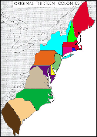
Can you name each of these colonies?
-
Which colonies were considered Southern? Which were Middle or Mid-Atlantic? Which were Northern or New England? (Click to find out.)
-
Immigrants to the colonies and where they settled (map)
-
Timeline of Events During the Colonial and Revolutionary War Years
Early Settlements--Roanoke Island or "The Lost Colony"
Early Settlements--Jamestown
Early Settlements--Plymouth
-
Plymouth Plantation (click and scroll down to see photos of the rebuilt settlement of "Plimouth")
-
Tour Plimouth (360 degree views) to see how early colonists lived.
-
The Mayflower II (replica of the original ships that carried Separatists to the Plymouth).
-
Virtual Field Trip to Plymouth (view pictures by scrolling down; click on the link below the photos to continue)
-
The Mayflower Compact (a document in which the Plymouth colonists agreed to govern themselves)
-
More cool links relating to Pilgrims, the Mayflower, and Plymouth, and Cape Cod, Massachusetts!
Mid-Atlantic (Middle) Colonies
-
Location of the Mid-Atlantic Colonies (map)
-
Sketches of Quakers
-
William Penn--Quaker founder of Pennsylvania who believed in religious tolerance.
-
What was Pennsylvania known for? Quakers and grain crops, such as oats!
-
Religious Diversity and Tolerance in the Middle Colonies (scroll to the middle of the page for information on New York, New Jersey, and Pennsylvania)
Colonists and Their Work
-
Women who were not wealthy often spun their own thread on spinning wheels, much like the woman in this photo from 1918.
-
Girls had chores, including churning butter.
-
Indentured Servants (good site--ignore the spelling error in the title of the page)
-
Advertisement for indentured servants to be sold
-
Slavery in Colonial Times (follow the links on this page from Colonial Williamsburg)
-
Artisans (craftsmen and craftswomen)--although only about 10% of colonists worked in these trades, they were very important!
-
Farm Families and Some of Their Chores in Colonial Times
Trade--Political and Economic Relationships Between the Colonies
Unit 5--Revolutionary War
-
Loyalists (Tories) in the American Revolution
-
Life at the Time of the American Revolution (PBS)
-
The History Place
-
Map of the Colonies at the End of the Revolutionary War
-
The Patriot Point of View
-
The Loyalist Point of View
-
Play the Loyalist/Patriot Game (Decide whether you are a Loyalist or a Patriot and uncover clues by visiting sites.)
-
Liberty's Kids
Causes of the American Revolution
-
Proclamation Line of 1763
-
Read the actual Stamp Act passed by Parliament in 1765. (How many items were to be taxed?)
-
The Stamp Act (stamp on a colonial newspaper)
-
The Stamp Act
-
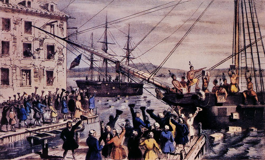
The Tea Tax and the revolt known as the Boston Tea Party
-
Tax collection (tarring and feathering of a tax collector)
-
Daniel Boone and others crossed the Proclamation Line! (click for a short biography of Daniel Boone)
More Events Leading to the American Revolution
-
The Boston Massacre (engraving by Paul Revere)
-
The Boston Gazette (newspaper account of the Boston Massacre)
-
Obituaries of some of the men who died in the Boston Massacre.
-
Crispus Attucks (killed in the Boston Massacre)
-
The Boston Massacre (timeline, first-hand accounts, details of the trial, and more)
-
The Boston Tea Party
-
The Boston Tea Party (engraving and an eye-witness account)
-
The Robinson Half-Chest (tea chest that was dumped into the Boston harbor Dec. 16, 1772)
Major Events of the American Revolution
-
Common Sense pamphlet (published by Thomas Paine in 1776)
-
The Declaration of Independence (July 4, 1776)
-
The Battle of Saratoga (turning point in the war because the victory by the Americans caused European countries such as France and Spain to help the colonies)
-
Timeline of Important Events
-
Play "The Road to Revolution Game"--click here!
-
Boston in 1774
-
Boston in 1776
-
Timeline of Events of the Revolution with links to other sites!
-
The Declaration Independence (National Archives Site)
-
Click here to see what Paul Revere said about his midnight ride of 1775
Major Battles of the American Revolution
-
The Midnight Ride of Paul Revere on April 18, 1775 (click the links from this page to learn more!)
-
Another look at Paul Revere's Ride (including a map of the route)
-
The Battles at Lexington and Concord on April 18, 1775 (click and scroll down for details)
-
The Battles at Lexington and Concord (a brief summary)
-
The Battles at Lexington and Concord
-
Saratoga (the battle in New York that was the "turning point" of the war)
-
Yorktown and the Surrender of Lord Cornwallis to George Washington
Famous People of the American Revolution
-
Paul Revere (video clip)
-
Ben Franklin (video clip part 1)
-
Ben Franklin (video clip part 2)
-
Ben Franklin
-
King George III
-
Patrick Henty--portrait
-
Patrick Henry and the Speech to the Virginia Delegation (Give me liberty or give me death!)
-
George Washington--Commander of the Continental Army
-
Thomas Paine (author of the pamphlet Common Sense)
-
Phillis Wheatley (African American poet who supported the Revolution)
-
Phillis Wheatley (and some of her more famous poems)
-
Famous People of the Revolution (click and scroll down to see portraits; click on the portrait for the biography and famous quotes)
After the American Revolution
Advantages of the Americans During the Revolution
Unit 6--Founding Period of the United States
-
The Three Branches of the Federal Government
-
Presidents of the United States (Study G. Washington, J. Adams, T. Jefferson, J. Madison and J. Monroe)
-
Timeline of Events During the Founding Period through the Civil War Era
-
The Virginia Plan
http://www.classbrain.com/artteenst/publish/article_34.shtml
The First Political Parties
The Constitution of the United States of America
-
Comparing the Constitution to the Articles of Confederation
-
The Contitution of the United States of America
-
The Census
-
The Three Branches of the Federal Govenment
-
The Constitutional Convention (Philadelphia, Pennsylvania in 1787)
-
The Contitution (National Archives Site)
-
The Bill of Rights (National Archives Site)
John Adams' Presidency/Administration
Thomas Jefferson's Presidency/Administration
The James Monroe Presidency/Administration
Unit 7--Western Expansion, Change and Reform 1801-1860
-
Expansion of the U.S.-Animation of the First 48 States
-
Animated map of territorial expansion
-
Why the Gadsden Purchase was purchased (animated map)
-
The U.S. in the Mid-1800s
The Louisiana Purchase and Exploration by Lewis and Clark
Texas
War with Mexico and the Mexican Cession
African American History
Unit 8--Civil War and Reconstruction
-
The History Place (Great timeline--cool links to information on specific people and events!)
-
Virginia in 1830
Causes of the Civil War
Compromises Before the Civil War
Famous People of the Civil War
-
Can you name this Confederate general from Virginia?
-
Can you name this Virginian who would not fight against his state and who led the Army of Northern Virginia?
-
Can you name this Union general who accepted the surrender of Gen. Robert E. Lee at Appomattox Courthouse?
-
Can you name this Civil War nurse and founder of the American Red Cross?
.JPG)